-
E-mail
market@aozuo.com.cn
-
Phone
15811022840
-
Address
Unit 1, 1st Floor, Building 6, Courtyard 3, Haidian District, Beijing
Product Categories
Beijing Aozuo Ecological Instrument Co., Ltd


Wind erosion/water erosion measurement system
NegotiableUpdate on 12/22
- Model
- Nature of the Manufacturer
- Producers
- Product Category
- Place of Origin
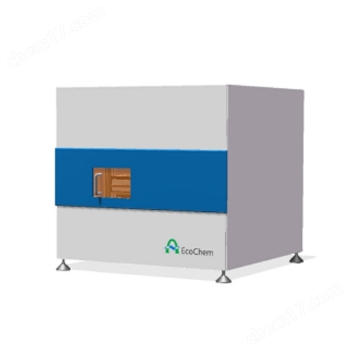
Overview
The wind erosion/water erosion measurement system is used to monitor the natural trend of wind and sand movement, soil wind erosion, soil desertification and desertification monitoring, soil organic matter (SOC) erosion, etc.
Product Details
Wind erosion/water erosion measurement systemUsed to monitor the trend of wind and sand movement in nature, soil erosion, soil desertification and desertification monitoring, soil organic matter (SOC) erosion, etc.
Working principle and characteristics of the system
Working principle: The data acquisition unit automatically records the data from the wind erosion sensor. The wind erosion sensor counts wind and sand particles by measuring the kinetic energy of the wind and sand hitting the sensor interface. At the same time, it can measure other environmental parameters such as wind speed and direction, air temperature and humidity, and record the environmental conditions under which wind erosion occurs.
The system automatically records the starting time and intensity of sediment erosion, as well as the cumulative amount of sediment changes over time in the wind profile;
Record meteorological parameters during the relevant process;
The collected wind and sand particles can be used to analyze the composition of wind eroded materials in the laboratory;
It is possible to freely set the recording of data only when there is wind and the wind speed is less than a certain measurement value, which saves storage capacity and avoids the influence of wind pressure on the measurement results of traditional sediment collectors;
The shaft of the wind and sand collector adopts an open design, and sand cannot stay at the shaft, ensuring long-term use and maintenance free;
The sandstorm collector can set the number and height of collected profiles arbitrarily, which is very convenient;
The wind and sand collector is compact and easy to carry;
The power supply adopts a solar power supply system to ensure long-term operation;
The wind erosion flux sensor can count wind sand particles, analyze dynamic energy and high pulse, providing necessary data support for measurement work;
Various environmental factor sensors can be optionally selected, such as air temperature and humidity, wind speed and direction, air pressure, solar radiation, soil temperature, and rainfall, etc;
Optional ENVIdata online data management software, used for remote GPRS data transmission, monitoring system operation status, etc;
sensor
Surface wind erosion sensor
maintenance-free
Can be used in remote wind erosion monitoring stations
Working voltage: 8-20VDC 8.6mA
Immediately and accurately provide motion for almost all particles
Output pulse signal to measure the momentum flux of sand
The principle is that the amount of charge is proportional to the kinetic energy of the particle
TTL/CMOS compatible pulse, pulse width 1.00mS
No moving parts
The working voltage is DC 8-20V
The output pulse signal is used to measure the momentum flux of sand, with two outputs being kinetic energy and the number of particles impacted
The principle is that the amount of charge is proportional to the kinetic energy of the particle. The relationship between charge, voltage, and capacitance is q=CV., V=q/C
TTL/CMOS compatible pulse, pulse width 1.00mS
Collection port size: 2 × 5cm (width × height)
Screen mesh: 60 mesh
Collection rate: 90% of dust in the air
Collector capacity: 1.7Kg
Service life: approximately 10 years
Sensors are highly integrated and can measure multiple parameters. The wind direction and speed adopt advanced ultrasonic technology, with built-in GPS receiving function. Long term use without maintenance. Especially suitable for coastal or eroded areas.
Measurement parameters: wind speed, wind direction, air temperature (measured by ultrasonic waves), air humidity, air pressure, light intensity, rainfall.
Channel: Analog input: 5-15 single ended channels (10 differential); Pulse channels: 12; Digital I/O ports: 8
Processor: Equipped with an 18 bit A/D converter, with an accuracy of ± 0.025%
USB storage: compatible with USB 1.1 or USB 2.0 drivers, capable of collecting approximately 90000 digital points per megabyte
LCD display, 2-line 16 letter LCD display and 6 buttons for viewing channel and data acquisition status and function execution
Communication: RS232, USB, Ethernet, etc
Sampling interval: 10ms to days, customizable
Output value types: Average, Maximum, Minimum, Sample, Vector, Total
ENVIdata data transmission and management
The system directly transmits data to the www.ecodata.net (China Ecological Data Network) website, and determines the status development of the monitored object through the temporal changes and correlation analysis of the monitored ecological environment factors.
The ENVIdata server software can be used as a standalone application software and run on the user's server; It can also run on secure servers of Australian companies, providing data reception services for multiple users and helping users monitor the operating status of hardware systems at field measurement points.
The ENVIdata series ecological environment monitoring system of Ausoo Company has successfully obtained ISO9001 international quality system certification in the industry. It obtained ISO9001 quality certification in 2010 and has passed the annual review of experts to ensure the quality of system integration. Users can log in with their username and password, and as long as they can access the internet, they can browse real-time and historical data
Features:
1) Ecological environment information is sent to the website at various time intervals (minutes, hours, days).
2) Users can browse real-time data as long as they have internet access.
3) Chinese interface of the central server, easy to operate and manage
4) Provide multi parameter, real-time or historical data curve graphs
5) The system provides multi site map display
Monitoring and research on soil wind erosion on different underlying surfaces in the agricultural pastoral transitional zone of Bashang, Hebei Province. Land desertification, as a form of land degradation, has become a major ecological and socio-economic problem in northern China. Seriously affecting and troubling the survival and sustainable social development of the area and surrounding regions.
In response to the ecological environment degradation in the Bashang area of Hebei Province, from April 7 to May 12, 2005, during the strong wind season in the Bashang area, the "trap capture" method of burying sand collection discs on the ground and the method of burying wind erosion discs were used to monitor the wind erosion status of different types of land parcels in the beach and beam areas in the field, providing theoretical and technical basis for the prevention and control of wind erosion in the Bashang area.
In recent years, due to global temperature warming, several tributaries in the upper reaches of the the Yarlung Zangbo River have dried up, and the sand in the riverbed has gradually eroded the surrounding mountains due to perennial wind, which has caused serious damage to the local environment. The monitoring and control of wind erosion is urgently needed. Xizang Agriculture and Animal Husbandry University uses the ENVIdata wind erosion environmental monitoring system of the company to send the monitoring data to the China Ecological Data Network in real time. The system is installed near Lhasa Gongga Airport, which can count and weigh the amount of wind sand and monitor the kinetic energy of wind sand, providing relevant theoretical data for local wind erosion prevention.
Working principle and characteristics of the system
Working principle: The data acquisition unit automatically records the data from the wind erosion sensor. The wind erosion sensor counts wind and sand particles by measuring the kinetic energy of the wind and sand hitting the sensor interface. At the same time, it can measure other environmental parameters such as wind speed and direction, air temperature and humidity, and record the environmental conditions under which wind erosion occurs.

Features:
The system automatically records the starting time and intensity of sediment erosion, as well as the cumulative amount of sediment changes over time in the wind profile;
Record meteorological parameters during the relevant process;
The collected wind and sand particles can be used to analyze the composition of wind eroded materials in the laboratory;
It is possible to freely set the recording of data only when there is wind and the wind speed is less than a certain measurement value, which saves storage capacity and avoids the influence of wind pressure on the measurement results of traditional sediment collectors;
The shaft of the wind and sand collector adopts an open design, and sand cannot stay at the shaft, ensuring long-term use and maintenance free;
The sandstorm collector can set the number and height of collected profiles arbitrarily, which is very convenient;
The wind and sand collector is compact and easy to carry;
The power supply adopts a solar power supply system to ensure long-term operation;
The wind erosion flux sensor can count wind sand particles, analyze dynamic energy and high pulse, providing necessary data support for measurement work;
Various environmental factor sensors can be optionally selected, such as air temperature and humidity, wind speed and direction, air pressure, solar radiation, soil temperature, and rainfall, etc;
Optional ENVIdata online data management software, used for remote GPRS data transmission, monitoring system operation status, etc;
sensor
Surface wind erosion sensor
maintenance-free
Can be used in remote wind erosion monitoring stations
Working voltage: 8-20VDC 8.6mA
Immediately and accurately provide motion for almost all particles
Output pulse signal to measure the momentum flux of sand
The principle is that the amount of charge is proportional to the kinetic energy of the particle
TTL/CMOS compatible pulse, pulse width 1.00mS

Wind erosion mass flux sensor:
No moving parts
The working voltage is DC 8-20V
The output pulse signal is used to measure the momentum flux of sand, with two outputs being kinetic energy and the number of particles impacted
The principle is that the amount of charge is proportional to the kinetic energy of the particle. The relationship between charge, voltage, and capacitance is q=CV., V=q/C
TTL/CMOS compatible pulse, pulse width 1.00mS

Wind and sand collector:
Collection port size: 2 × 5cm (width × height)
Screen mesh: 60 mesh
Collection rate: 90% of dust in the air
Collector capacity: 1.7Kg
Service life: approximately 10 years

Sensors are highly integrated and can measure multiple parameters. The wind direction and speed adopt advanced ultrasonic technology, with built-in GPS receiving function. Long term use without maintenance. Especially suitable for coastal or eroded areas.
Measurement parameters: wind speed, wind direction, air temperature (measured by ultrasonic waves), air humidity, air pressure, light intensity, rainfall.

data collector
Channel: Analog input: 5-15 single ended channels (10 differential); Pulse channels: 12; Digital I/O ports: 8
Processor: Equipped with an 18 bit A/D converter, with an accuracy of ± 0.025%
USB storage: compatible with USB 1.1 or USB 2.0 drivers, capable of collecting approximately 90000 digital points per megabyte
LCD display, 2-line 16 letter LCD display and 6 buttons for viewing channel and data acquisition status and function execution
Communication: RS232, USB, Ethernet, etc
Sampling interval: 10ms to days, customizable
Output value types: Average, Maximum, Minimum, Sample, Vector, Total
ENVIdata data transmission and management
The system directly transmits data to the www.ecodata.net (China Ecological Data Network) website, and determines the status development of the monitored object through the temporal changes and correlation analysis of the monitored ecological environment factors.
The ENVIdata server software can be used as a standalone application software and run on the user's server; It can also run on secure servers of Australian companies, providing data reception services for multiple users and helping users monitor the operating status of hardware systems at field measurement points.
The ENVIdata series ecological environment monitoring system of Ausoo Company has successfully obtained ISO9001 international quality system certification in the industry. It obtained ISO9001 quality certification in 2010 and has passed the annual review of experts to ensure the quality of system integration. Users can log in with their username and password, and as long as they can access the internet, they can browse real-time and historical data
Features:
1) Ecological environment information is sent to the website at various time intervals (minutes, hours, days).
2) Users can browse real-time data as long as they have internet access.
3) Chinese interface of the central server, easy to operate and manage
4) Provide multi parameter, real-time or historical data curve graphs
5) The system provides multi site map display

Application Case 1:
Monitoring and research on soil wind erosion on different underlying surfaces in the agricultural pastoral transitional zone of Bashang, Hebei Province. Land desertification, as a form of land degradation, has become a major ecological and socio-economic problem in northern China. Seriously affecting and troubling the survival and sustainable social development of the area and surrounding regions.
In response to the ecological environment degradation in the Bashang area of Hebei Province, from April 7 to May 12, 2005, during the strong wind season in the Bashang area, the "trap capture" method of burying sand collection discs on the ground and the method of burying wind erosion discs were used to monitor the wind erosion status of different types of land parcels in the beach and beam areas in the field, providing theoretical and technical basis for the prevention and control of wind erosion in the Bashang area.

In recent years, due to global temperature warming, several tributaries in the upper reaches of the the Yarlung Zangbo River have dried up, and the sand in the riverbed has gradually eroded the surrounding mountains due to perennial wind, which has caused serious damage to the local environment. The monitoring and control of wind erosion is urgently needed. Xizang Agriculture and Animal Husbandry University uses the ENVIdata wind erosion environmental monitoring system of the company to send the monitoring data to the China Ecological Data Network in real time. The system is installed near Lhasa Gongga Airport, which can count and weigh the amount of wind sand and monitor the kinetic energy of wind sand, providing relevant theoretical data for local wind erosion prevention.


Similar Product Recommend