-
E-mail
bj6213@126.com
-
Phone
13261994018
-
Address
Room 305, Building 22, No. 10 Rongcheng North Road, Huairou District, Beijing
Product Categories
- High standard farmland construction equipment
- Plant Protection Meteorological Station
- Meteorological monitoring equipment
- Micro meteorological station
- ultrasonic sensor
- Integrated water and fertilizer equipment
- air quality
- Integration of water and fertilizer
- Plant protection equipment and instruments
- meteorological equipment
- sensor
- Soil equipment
- Plant protection instruments and equipment
- Hydrology and Water Conservancy
- Soil moisture, soil moisture, hardness, compactness equipment
- Smart Agriculture
Beijing Mengchuang Weiye Technology Co., Ltd

Scenic Area Meteorological Environment Monitoring Station
NegotiableUpdate on 05/07
- Model
- Nature of the Manufacturer
- Producers
- Product Category
- Place of Origin
Overview
Scenic Area Meteorological Environment Monitoring Station
Product Details
MC-QXSQtypeLinjing Districtmeteorological phenomenaenvironmentmonitorstand
productApplication:

Automatic meteorological and environmental monitoring stations in scenic areas are widely used in agriculture, forestry, grasslands, scenic spots, and other environments to monitor climate, ecological environment, geological disasters, and harsh environments(-Long term monitoring under conditions of 40 ℃ -80 ℃. Through long-term continuous monitoring of key ecological environment indicators such as air temperature and humidity, precipitation, wind direction, wind speed, atmospheric pressure, soil moisture, soil pH, soil salinity, soil conductivity, soil water potential, evaporation, soil moisture, sunshine and radiation, oxygen content, negative oxygen ions, carbon dioxide concentration, etc., the qualitative and quantitative reflection of the atmospheric component regulation function, moisture regulation function, purification function, and local microclimate regulation function of forests, grassland wetlands, and scenic reserves on ecological environment changes is provided, providing scientific basis for climate ecological environment evaluation and grassland wetland ecological environment monitoring services.
Functional features:
This system mainly consists of a drama collector, environmental sensors, video surveillance system, and IoT data remote management platform. The data platform is a networked platform with Internet architecture, which has the monitoring function for each sub station, as well as the alarm processing, recording, query, statistics, report output and other functions for data.

Collector host performance:
1. Low temperature working test:
exist-Under the condition of 40 ℃, the sample works for 2 hours when powered on. During the experiment, the sensor data of the sample can be viewed through the intelligent cloud platform.
2. High temperature working test:
existUnder the condition of 60 ℃, the sample works for 2 hours when powered on. During the experiment, the sensor data of the sample can be viewed through the intelligent cloud platform.
3. Constant humidity and heat working test:
existUnder the conditions of 40 ℃ and 95% RH, the sample was powered on and operated for 2 hours. During the experiment, the sensor data of the sample can be viewed through the intelligent cloud platform.
4. Data collector system functions: It can support true color 4-inch and 8-inch touch screens, OLED self luminous screen Chinese display collectors, touch screen audio reminders, support communication interfaces, support offline and 4G online networking methods, data collection, data collection can be randomly stored or uploaded to cloud servers, storage function, powerful setting interface function, clock display and settings, support GPS module for global satellite positioning latitude, longitude, altitude, multi-channel data collection, wireless network transmission, support for multi camera photography and other functions.
5. Chinese display: dialog boxes, menus, icons, windows, and other interfaces support Chinese display.
6. Localization level: Except for professional terminology, software products are localized in Chinese.
7. The collector software has various information that is easy to understand, browse, and user-friendly. The software conforms to Chinese usage habits.
8. Collector host optionalconfiguration8-inch DGUS touch screen, locally and remotely controllable, detailed product parameters:
Touch Screen8.0-inch, 800 × 600 graphic dot matrix, K600+core, 16.7M color, DGUS screen.
Automatic Meteorological Environment Monitoring Stationcharacteristic:
1. The collector can choose true color 4-inch, 8-inch touch screens, OLED self luminous screen hosts, with high background brightness and built-in intelligent operating system.
2. Industrial grade design with strong anti-interference ability. The backlight can be automatically turned off to reduce power consumption. The outer shell is sealed with ABS plastic shell, which is sturdy, durable, and not easily aged.
3. Built in international standard 485 communication data acquisition module, automatically identifies various types of 485 sensors for users, without the need for installation by location. Up to 256 sensors can be collected.
4. The 4-inch and 8-inch touch screen collectors can view data locally, display charts, set collection settings, and automatically collect data according to the user's set collection interval. The touch screen collector is suitable for environments ranging from -20 ℃ to 70 ℃.
 5CommonThe OLED collector host adopts a self luminous mode, which does not require local settings. It only needs to check the device's operating status. In power-saving mode, the screen will turn off, and the reset button can be pressed to light up the screen.CommonThe working environment of OLED screen collector is -50 ℃ -80 ℃, suitable for extremely cold and hot environments, with a wider range.
6. The host can be powered by AC/220V, outdoor solar power, or a built-in lithium battery pack (with a continuous power supply of over 72 hours). Users can carry the device for mobile testing.
7. The host adopts multiple remote data transmission methods for users to choose from, including Ethernet, WiFi wireless signals, 4G data wireless transmission, which can transmit data in real time to the IoT data platform.
8. Storage function: Random storage of no less than 30 million sets. Equipped with a standard 4G memory card, it can hold up to 16GB of memory.
9. Reserved 485 data output port, which can be connected to outdoor or indoor LED display screens, displaying real-time data of various parameters prominently.
10. It can support the connection of multi-point camera, with a pixel size of 2-5 million, and can monitor the environment, plant fruits, stem growth changes, etc. at fixed points. The photos can be connected to the server platform.
Intelligent IoT data application cloud platform software features:
1. It can achieve functions such as registering an intelligent cloud platform account and logging into the system.
2. It can enable users to add the unique device code to their own account after purchasing our company's smart devices.
3. It can achieve real-time data from wireless data acquisition and control equipment, as well as real-time data from meteorological stations.
4. It can realize the visualization of data display such as curve charts, bar charts, pie charts, etc., making it convenient for users to make judgments.

|
5. It can achieve remote manual control of the operation and shutdown of controllable devices, as well as intelligent control, making it more convenient to automatically control real-time data collected by sensors.
 6. Chinese display: dialog boxes, menus, icons, windows, and other interfaces should support Chinese display.
7. Degree of Sinicization: Except for professional terminology, software products should be translated into Chinese.
8. The software provides installation and uninstallation functions, and various information is easy to understand, browse, and operate for users. The software conforms to Chinese usage habits.
9. The camera takes photos and connects them to the server platform for direct viewing, enabling the overlay of meteorological data images with text and images. It can monitor changes in the environment, plant fruits, and stem growth. The data collector or computer measures the daily and long-term growth changes of plants in real time through the signal changes of the bridge shaped tension probe of the caliper.
10. Design a user-friendly environmental monitoring and management system using visual programming language to achieve remote monitoring of the monitored environment. You can freely set the upper and lower limit values. Alarm through SMS and other means. The software platform can remotely monitor real-time data from various sensors. Complete data management functions, supporting various data processing such as database management, data query, export, printing, statistical analysis, chart analysis, etc.
11. The manifestation of online monitoring of various environmental factor parameters: A. List detailed format, which can intuitively view the monitoring data of various environmental factor parameters at a certain time point. B、 The display method of curve trend chart, C、 Column style trend display, etc.

12. Support mobile APP, WeChat official account and computer to view real-time data and historical data of various parameters at any time.
13. The video surveillance platform supports video monitoring of multiple outdoor waterproof cameras in outdoor production environments and other areas. At the remote end, real-time monitoring, supervision, warning, and command intelligence can be achieved through Ethernet. Improve communication efficiency and accuracy.
14. GIS map generation: Using the built-in GPS module of the detection device, satellite positioning data is bundled with test data information to implement GIS map fixed-point monitoring of the position information of each detection point. The monitor can click on the position coordinates on its satellite positioning icon to view the relevant index information of the test data of the detection point.


 15、GPS satellite positioning system: a multi satellite positioning system that integrates GPS, BeiDou, and QZSS for concurrent reception, supports synchronous reception of GPS, BeiDou, and QZSS L1 frequency bands, and has 33 tracking channels, 99 capture channels, and up to 210 PRN channels, capable of tracking and capturing any mixed signal of GPS and BeiDou.
No of channels33 tracking channels, 99 capture channels SBAS: WAAS, EGNOS, MSAS, GAGAN
Horizontal positioning accuracy:<2.5m CEP (autonomous positioning), speed accuracy:<0.1m/s (autonomous positioning)
Acceleration accuracy:<0.1m/s2 (autonomous positioning), recapture time:<1s
TTFF @ -130dBm AGPS Assist: Cold Start:<15s, Warm Start:<5s, Hot Start:<1s
TTFF @ -130dBm without AGPS assistance: Cold start:<35s, Warm start:<30s, Hot start:<1s
sensitivityCapture: -148dBm Tracking: -161dBm Recapture: -165dBm
dynamicsMaximum height: 18000m Maximum speed: 515m/s Maximum acceleration: 4.0g
General characteristicsWorking temperature: -40 ° C~+85 ° C
Configuration List(Optional):
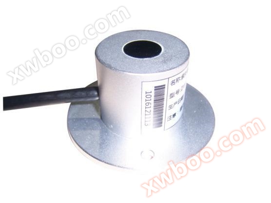
1. Fixed bracket (ground cage): 2-meter, 2.5-meter, 3-meter, 5-meter, 10 meter or customized height material bracket. Optional triangular mobile bracket. 2. Windproof zipper (5 meters); 3. Horizontal arm and other accessories; 4. Lightning protection (over 5 meters); 5. Solar panel (bracket)/220V AC power;6. Battery (controller); 7. Protective box; 8. Radiation hood (temperature, humidity and pressure); 9. Touchscreen collector host; 10. Sensors: sensors for air temperature, air humidity, wind direction, wind speed, rainfall, atmospheric pressure, light intensity, soil temperature and humidity, etc;11. GPRS wireless transmission module; 12. Video surveillance camera;13. Waterproof LED display, etc.
Common testing items for environmental monitoring stations in forestry and grassland scenic areas:(Optional)
|
product name |
Function Parameter |
quantity |
|
Dust(PM2.5、PM10,PM1.0) |
Response time:≤3 Seconds;Measurement range:0.3-1.0,1.0-2.5,2.5-10(um) Minimum Resolution:0.3Micrometer; Maximum range:0~1000ug/m3 |
1 |
|
noise |
Measurement range:30dB~110dBAccuracy:0.5%;Stability:less than2% |
1 |
|
fallrainfall |
Measurement range:≤4mm/min(precipitation intensity); resolving power:0.2mm(6.28ml) |
1 |
|
rain and snow |
Measurement of rain and snow, response time≤0.5S. |
1 |
|
Light intensity |
Measurement range:0-200,000Lux;Accuracy:±3%FS |
1 |
|
ultraviolet radiation |
Measurement range:0~70W/㎡;Spectral range:280~400nm |
1 |
|
Total radiation |
Spectral range:0.3~3μm;Measurement range:0~2000W/m2, |
1 |
|
sunshine duration |
Spectral range:0.3~3μm;Measurement range:0~2000W/m2Count the sunshine every minute and reset it to zero at midnight every day.resolving power:0.1hWhen the direct radiation value is greater than120W/m2Start accumulating. |
1 |
|
temperature |
Measurement range:-40℃~85℃,Measurement accuracy:0.1℃. |
1 |
|
soil moisture |
range0~100%,Measurement accuracy:3% |
1 |
|
air temperature |
Temperature range: standard configuration-40~70℃;Accuracy:±0.2℃(@25℃); Repeatability: ±0.1℃; |
1 |
|
air humidity |
Humidity range:0~100%RH(Non condensing state);Accuracy:±3%RH(10%~90%);Repeatability:±0.1%RH |
1 |
|
atmospheric pressure |
Measurement range:10~1100hpa;Measurement accuracy:0.1hpa |
1 |
|
wind speed |
Measurement range:0~60m/s;Response time:<1S;Start wind power:0.4~0.8m/s |
1 |
|
wind direction |
Measurement range:0~360°;Accuracy:±3°;Start wind speed:≤0.5m/s |
1 |
|
carbon dioxide |
Measurement range:0~5000ppm;Accuracy:±3%F•S(25℃);Stability:≤2%F•S |
1 |
|
negative oxygen ion |
Detection range:10~5000000(individual/cm3)Resolution:10An ion/cm3Sampling rate:1second/One; Error: Ion concentration ≤±10%Migration rate:1(cm2/S*V) |
1 |
|
oxygenO2 |
Range:0~25%VolMaximum measurement limit:30%Vol;sensitivity:(0.10±0.05)mA (in air)resolving power:0.1ppm;Response time(T90):≤15SRepeatability:<2% output value |
1 |
|
Camera for photography |
4GCamera for photography, compact and easy to install, with pixel resolution200-500Ten thousand pixels, collector host controls power supply, sets camera parameters, and data photos independently4GUpload to the server platform, which can be overlaid with meteorological data graphics and text to achieve functions such as monitoring the environment, plant growth status, and fixed-point monitoring. |
1 |