-
E-mail
bj6213@126.com
-
Phone
13261994018
-
Address
Room 305, Building 22, No. 10 Rongcheng North Road, Huairou District, Beijing
Product Categories
- High standard farmland construction equipment
- Plant Protection Meteorological Station
- Meteorological monitoring equipment
- Micro meteorological station
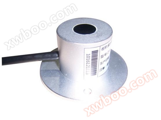
- ultrasonic sensor
- Integrated water and fertilizer equipment
- air quality
- Integration of water and fertilizer
- Plant protection equipment and instruments
- meteorological equipment
- sensor
- Soil equipment
- Plant protection instruments and equipment
- Hydrology and Water Conservancy
- Soil moisture, soil moisture, hardness, compactness equipment
- Smart Agriculture
Beijing Mengchuang Weiye Technology Co., Ltd

Farmland Microclimate Monitoring Station
NegotiableUpdate on 05/07
- Model
- Nature of the Manufacturer
- Producers
- Product Category
- Place of Origin
Overview
Farmland Microclimate Monitoring Station
Product Details
Scope of application:
Used for scientific research, teaching, and guiding agricultural production and daily life,And various needs to monitor the air temperature in the environment online and accurately at any timeAir humidity, wind direction, wind speed, atmospheric pressureilluminanceMonitoring items such as rainfall, soil temperature, and soil moisture,And real-time upload all collected data to the IoT platform for remote storage, allowing real-time and historical data to be viewed at any time through mobile phones or computers.

Product features:
This system is mainly composed ofTouch ScreenDrama CollectionEquipment and environmentsensingimplement、Composed of video surveillance system, IoT data remote management platform, etc.The data platform is a networked platform with Internet architecture, which has the monitoring function for each sub station, as well as the alarm processing, recording, query, statistics, report output and other functions for data.
1. CollectorThe host adopts a 3.5-inch true color touch screen,High background brightness, built-in intelligent operating system, and finger touch operation.
2. Industrial grade design with strong anti-interference ability. The backlight can be automatically turned off to reduce power consumption. The shell is made of spray coated steel plate stamping, which is sturdy, durable, and not easily aged.
3. Built in international standard 485 communication data acquisition module, automatically identifies various types of 485 sensors for users, without the need for installation by location. Up to 256 sensors can be collected.
4. Automatic data collection can be achieved according to the collection time interval set by the user.
5. The host adopts various installation forms and is equipped with a dedicated multifunctional hanging board. Users can use mobile brackets, wall mounted brackets, etc. according to their actual needs and environmental conditionsVarious methods such as keel suspension and hoisting make installation easy.
6. The host can be powered by AC/220V, outdoor solar power, or a built-in lithium battery pack (with a continuous power supply of more than 12 hours),Users can carry their devices for mobile testing.
7. The host adopts multiple remote data transmission methods for users to choose from, including Ethernet, WiFi wireless signal, GPRS data wireless transmission, which can transmit data in real time toIoT data platform.
8Storage function: RandomStorage not less than30Million setsComes standard with a 2G memory card, with a maximum capacity of 16GB of memory.
9Reserved 485 data output port, which can be connected to outdoor or indoor LED display screens, displaying real-time data of various parameters prominently.
10. Design a user-friendly environmental monitoring and management system using visual programming language to achieve remote monitoring of the monitored environment. You can freely set the upper and lower limit values.Alarm through SMS and other means. The software platform can remotely monitor real-time data from various sensors. Complete data management functions, supporting various data processing such as database management, data query, export, printing, statistical analysis, chart analysis, etc.
11. The manifestation of online monitoring of various environmental factor parameters: A. List detailed format, which can intuitively view the monitoring data of various environmental factor parameters at a certain time point.
B、 The display method of curve trend chart, C、 Column style trend display, etc.

12. Support mobile APP, WeChat official account and computer to view real-time data and historical data of various parameters at any time.
13. The video surveillance platform supports video monitoring of multiple outdoor waterproof cameras in outdoor production environments and other areas, and can be accessed remotelyReal time monitoring, supervision, warning, and command intelligence through Ethernet. Improve communication efficiency and accuracy.
14. GIS map generation: Utilizing the built-in GPS module of the detection device to bundle satellite positioning data with test data information and implement GISMap fixed-point monitoring of the location information of each detection point, and the monitor can click on the location coordinates on its satellite positioning icon to view the relevant index information of the test data for that detection point.

sensorTechnical Parameter:
1airTemperature range:standard configuration-30~70℃ Accuracy:±0.2℃; Repeatability:±0.1℃
2airhumidityRange:0~100%RH Accuracy:±3%RH(10%~90%) Repeatability:±0.1%RH
3atmospheric pressureMeasurement range:10~1100mbar Accuracy:0.1mbar
4wind speedMeasurement range:0-30m/s, 0-60m/s reaction time: < 1S Start wind power:0.4~0.8m/s
5wind directionMeasurement range:0~360° Accuracy:±3° Start wind speed:≤0.5m/s
6、Rainfall measurement range:0.01mm~4mm/min Accuracy:≤±3% resolving power:0.1mm
7Range of illumination intensity:0~200Klux Accuracy:±5% resolving power:0.1Klux
8Range of soil temperature measurement:-40~120℃ Accuracy:±0.2℃ resolving power:0.1℃
9、Range of soil moisture measurement:0~100% Accuracy:±3% resolving power:0.1%