- Phone
-
Address
No. 116, Qinxing New Village, Qinnan, Yancheng City, Jiangsu Province
Product Categories
Jiangsu Huahang Underwater Engineering Co., Ltd


How much does it cost for underwater foundation inspection of bridges in Beijing? - Condition of erosion and damage to pier pile foundation - How much is the fee for multi beam underwater scanning of riverbed sections
NegotiableUpdate on 05/06
- Model
- Nature of the Manufacturer
- Producers
- Product Category
- Place of Origin
Overview
How much does it cost for underwater foundation inspection of bridges in Beijing? What are the erosion and damage conditions of bridge pier pile foundation? How is the fee for multi beam underwater scanning operation of riverbed section? This time, water depth measurement operation is carried out within 50 meters upstream and downstream of Miguan Road Bridge in Miyun Reservoir, Beijing, to assist ROV underwater robots in bridge inspection tasks, provide water depth data within the bridge measurement area, and provide relative position water depth reference for maintenance in the later stage of construction. This project uses unmanned survey ships to plan the cross-section of the survey area at intervals of 10 meters, collect water depth data, and then export various formats of water depth data results after filtering and analysis by internal processing personnel to remove clutter.
Product Details
How much does it cost for underwater foundation inspection of bridges in Beijing? - Condition of erosion and damage to pier pile foundation - How much is the fee for multi beam underwater scanning of riverbed sections
How much does it cost for underwater foundation inspection of bridges in Beijing? - Condition of erosion and damage to pier pile foundation - How much is the fee for multi beam underwater scanning of riverbed sections
Recently, the Urban Bridge Management Office invited staff from the Engineering Inspection Center to use underwater inspection robots to inspect the underwater components of the bridge, marking the beginning of the underwater foundation inspection work for the super large bridge in our city.


The bridge spans both sides of the river, and the underwater foundation of the bridge is mostly below the water level line all year round. Due to the influence of the water body, underwater foundation testing is difficult. Routine inspections are not visible, resulting in some 'diseases' not being detected in a timely manner and missing out on good maintenance and repair opportunities. In order to have a better and detailed understanding of the underwater foundation condition of bridges and provide first-hand information for bridge maintenance and repair, the Municipal Urban Bridge Management Office has introduced underwater inspection robots from the Engineering Inspection Center to conduct "physical examinations" on submerged bridges.
Many bridge pile foundations have certain quality problems, but some of them may be overlooked. However, through bridge pile foundation testing, serious problems can be clearly identified through the test results. For these problems in bridges, appropriate reinforcement methods must be adopted to solve them. The construction unit can also choose a suitable reinforcement plan based on the test results and the specific requirements of the customer, and reinforce these problematic bridges at the appropriate time. Dangerous bridges have a high degree of danger. If these bridges are not reinforced and maintained in a timely manner, they are likely to become truly dangerous bridges and lose their purpose for reinforcement. For such bridges, it is possible to determine whether they need to be rebuilt or reinforced based on the test results.
There are various traditional water measurement methods, and generally speaking, single beam depth sounders, acoustic Doppler current profiling (ADCP), side scan sonars, water quality analyzers, and other equipment can be installed on ships to obtain measurement results in conjunction with GNSS positioning products and acquisition navigation and post-processing software. Widely used in underwater terrain and geomorphology measurement, hydrological and water quality measurement, and underground pipe survey tasks in river, lake, and waterway areas.


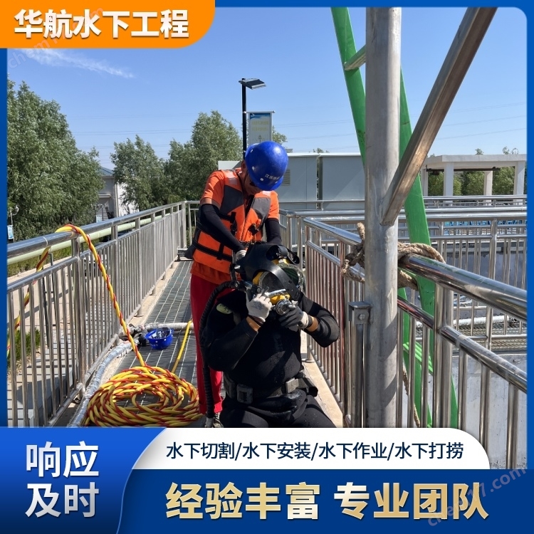
Before 2000, the inspection of bridges was mainly carried out by divers, but the water level in the river was relatively deep, and the main channel was over 18 meters deep, making underwater operations by divers relatively dangerous. In recent years, underwater detectors have been mainly used, but they cannot walk on their own and have poor operability.
The principle of unmanned ship depth measurement is actually similar to that of motorized survey ships, except that the depth sounder and GNSS RTK are integrated into the unmanned ship, and combined with the functions of manual remote control and autonomous route planning of the unmanned ship, it can replace motorized ships for measurement in the water area. Underwater terrain measurement includes the plane position and water depth measurement of measuring points. The plane position data is mainly determined by GNSS positioning technology (which can achieve centimeter level real-time positioning), and the water depth data is mainly obtained through a single beam depth sounder (generally high-precision depth sounders can also achieve centimeter level measurement accuracy). The bottom elevation of the measuring point can be obtained by subtracting the water depth from the water surface elevation (water level). By obtaining the planar and water depth positions of countless measuring points, the underwater terrain can be measured and displayed. Figure 1.6 is a schematic diagram of underwater terrain surveying work:
High precision positioning measurement must use carrier phase observation values. RTK positioning technology is a real-time dynamic positioning technology based on carrier phase observation values, which can provide real-time three-dimensional positioning results of the measuring station in the coordinate system and achieve centimeter level accuracy. In RTK operation mode, the reference station transmits its observation values and station coordinate information to the mobile station through a data link. The mobile station not only receives data from the reference station through data links, but also collects GNSS observation data and forms differential observation values in the system for real-time processing, while providing centimeter level positioning results in less than a second. The deployment of Beidou satellites enables GNSS receivers to search for more common solution satellites (at least 4), and even use Beidou single solution. More satellites can make GNSS receivers work more stably.


On the morning of the 20th, the inspection team boarded a boat and approached the third pier of the bridge. The staff put the underwater inspection robot into the water, and the person operated it on a tablet computer on the boat. The specific situation of nearly 10 meters underwater was clear at a glance. The inspection time for each bridge pier is about half an hour, and it only takes half a day to complete the inspection of the entire bridge. Compared to the previous week, it greatly improves work efficiency and produces more accurate data.
After the RTK reaches a fixed solution as shown in Figure 1, GPGGA data containing position information can be set for output. The depth sounder receives position information containing WGS84 latitude and longitude through the serial port and converts it into three-dimensional coordinates in the local plane coordinates (x, y, h) using coordinate system parameters. At this time, the three-dimensional coordinates obtained by the instrument are the position of the receiver phase center. By setting the antenna to the water surface height (H1) and measuring the water depth value with an ultrasonic echo type depth sounder, the three-dimensional coordinates (X, Y, Z) of the water bottom directly below the RTK can be calculated
Through underwater exploration in the past two days, it was mainly found that there was erosion on the downstream and south bank of Pier 3 of the bridge, forming a scouring pit of about 1.5 meters, which we need to restore in a timely manner. Overall, the water flow of the river is not significantly affected by changes in water level and erosion, and the overall base is safe.


The iBoat BSA hull serves as the main carrier for working sensors, equipped with unmanned ship intelligent control system, high-precision positioning and orientation system, single beam depth sounder, camera, millimeter wave radar active obstacle avoidance system, and intelligent lithium battery. The intelligent control system mainly implements intelligent control for the automatic navigation of unmanned ships and belongs to the core technology of unmanned ships; The positioning and orientation system consists of a GNSS receiver host and dual GNSS signal receiving antennas, which can provide position, heading, and ZDA information for the ship and measuring instruments; The single beam depth sounder can collect data directly below the hull, and the 360 ° high-definition camera can rotate to real-time understand the surrounding conditions of the hull. The combination of millimeter wave radar and intelligent ship control system can effectively avoid collisions between unmanned ships and obstacles ahead, ensuring safe navigation. The equipped detachable, intelligent modular lithium battery and ducted thruster can provide continuous power for unmanned ships for a long time.
Environmental requirements for underwater pile foundation testing of bridges during diving operations
1. Before diving operations, it is necessary to first understand or familiarize oneself with the underwater working environment, and be aware of obstacles that may affect diving operations, such as fishing nets, floats, etc.
2. Try to avoid night work as much as possible. If night work is necessary, sufficient lighting should be provided;


3. Lifting and other operations are not allowed above the diving operation area.
It is understood that the underwater foundation inspection of water crossing bridges is generally carried out during the dry season, mainly by scanning the terrain and erosion conditions around the pier pile foundation underwater, and identifying changes in the riverbed section and bridge foundation, providing detailed data for the later maintenance and management of the bridge. Our city will complete the underwater foundation inspection of the super large bridge by the end of this month.
Similar Product Recommend