- Phone
-
Address
Room 3023, 3025, Innovation Building, No. 101 West Fourth Ring South Road, Fengtai District, Beijing
Product Categories
Beijing Chuangpu Technology Co., Ltd
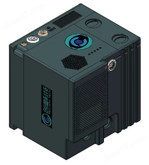
Handheld ground spectrometer
NegotiableUpdate on 05/06
- Model
- Nature of the Manufacturer
- Producers
- Product Category
- Place of Origin
Overview
TrFieldSpec #174; The series handheld ground spectrometer adopts fixed holographic grating splitting technology, with stable optical path, good repeatability, and fast measurement speed. The host is equipped with a GPS receiver, temperature and humidity sensors, atmospheric pressure sensors, and remote triggers, greatly enriching the accuracy and convenience of land information collection. The intelligent and multifunctional handheld measurement probe with innovative design integrates a fully automatic shutter, laser pointer, visible light camera, tilt sensor, and distance sensor, making it particularly suitable for outdoor, portable, and fully automatic measurement.
Product Details
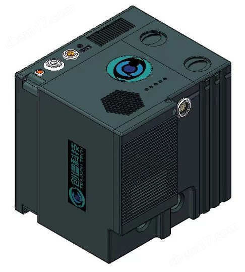
TrFieldSpec®
Handheld ground spectrometer
Portable ground spectrometer
Handled / Portable Field Spectroradiometer
ground object spectrometer
A Field Spectroradiometer is an optical instrument used to detect specific substances in the environment, soil, gas, or water by analyzing spectra to detect specific chemical components. It is mainly suitable for environmental monitoring, resource exploration, agriculture, earth science, and mineral exploration, and can be used to detect the content and changes of substances in the atmosphere, surface, and water bodies.
The ground object spectrometer is used for data collection on the surface and can be used to correct and compare satellite remote sensing spectral data (data correction). It is an instrument used to detect the reflection, radiation, and emission of electromagnetic waves from surface objects. Its principle is based on the difference in reflectivity and emissivity of surface objects under different wavelengths of electromagnetic waves. The spectrum of land cover is divided into different bands such as visible light, near-infrared, and infrared, among which visible light spectrum is the most common one.
Main application areas
In the field of agriculture and forestry: vegetation types, growth conditions, pests and diseases
Ecological environment field: soil type, organic matter content, water content
Mineral exploration field: rock types, mineral identification
Marine remote sensing field: marine pollution, red tide, suspended solids
Meteorological monitoring field: disaster monitoring, natural resource management
Product Description
TrFieldSpec ® The series of ground spectrometers are divided into three different models based on the wavelength range:
Handheld ground spectrometerTrFieldSpec-HH(200~1100nm)
Portable ground spectrometer TrFieldSpec-SWIR1.7 (200~1700nm)
Portable ground spectrometer TrFieldSpec-SWIR2.5 (200-2500nm)
TrFieldSpec ® The series of ground spectrometers adopts fixed holographic grating splitting technology, with stable optical path, good repeatability, and fast measurement speed. The host is equipped with a GPS receiver, temperature and humidity sensors, atmospheric pressure sensors, and remote triggers, greatly enriching the accuracy and convenience of land information collection. The intelligent and multifunctional handheld measurement probe with innovative design integrates a fully automatic shutter, laser pointer, visible light camera, tilt sensor, and distance sensor, making it particularly suitable for outdoor, portable, and fully automatic measurement. The compact and small structural design can meet various application scenarios such as outdoor single person carrying, indoor desktop, drone mounting, and land-based fixed. The ultra lightweight and portable design, replaceable long battery life, high-definition capacitive touch display screen, and wireless connection design of the display bring you a measurement experience.
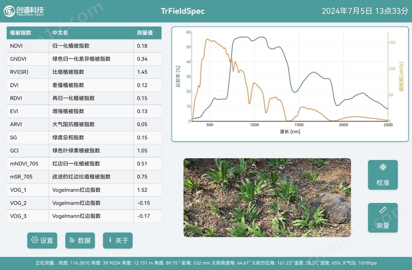
TrFieldSpec ® Spectral data measurement software
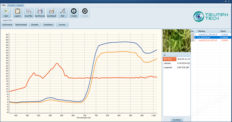
TrFieldSpec ® Spectral data analysis software
We have developed two professional software for land use applications:
Measurement software: used for data acquisition, it can easily collect and display reflection spectra, radiation spectra, solar azimuth, solar altitude, etc. in real time BRDF、 Vegetation index and other land information, and can switch between different measurement modes according to application scenarios.
Analysis software: Used for data processing, it can quickly read and display ground spectral data, and can perform integration, differentiation, smoothing, stitching, averaging, interpolation, differentiation, wavelength conversion, logarithmic operation, and various arithmetic operations on the data.
technical advantage
Fixed holographic grating beam splitter, stable optical path, good repeatability, fast measurement speed
Integrated GPS receiver, tilt sensor, distance sensor, temperature, humidity, and atmospheric pressure sensor
Built in fully automatic shutter, laser pointer, visible light camera, and remote trigger, especially suitable for outdoor, portable, and fully automatic measurement
Ultra lightweight and portable design, suitable for various application scenarios such as outdoor single person carrying, indoor desktop, drone mounting, land-based fixed, etc
Can wirelessly connect to displays and meet various personalized measurement needs
Structural design, particularly suitable for unmanned aerial vehicle mounted measurement applications
Rich software features, multiple measurement modes to choose from
Technical specifications
model |
TrFieldSpec-HH |
wavelength range |
200~1100nm |
spectral resolution |
≤2nm @ 200~1100nm |
Wavelength accuracy |
≤±0.2nm |
Wavelength repeatability |
≤±0.1nm |
Radiation calibration accuracy |
≤3% |
Spectral method |
Fixed holographic grating spectroscopy technology |
Number of detector channels |
2048 |
sampling interval |
0.5nm / 1nm / 5nm |
Maximum Measurable Radiation |
≥ 10 times the amount of sunlight |
sensor |
GPS receiver, tilt sensor, distance sensor, temperature and humidity sensor, atmospheric pressure sensor |
Optical input |
Fiber optic jumper/field of view lens (5 °, 10 °, 15 °, 25 °)/all day cosine probe |
Measurement assistance |
Laser pointer, automatic shutter, visible light camera, remote trigger, fully automatic gyroscope |
display screen |
5-inch capacitive touch screen |
working method |
Handheld and land-based fixed type |
Memory capacity |
128GB / 256GB / 512GB |
data saving |
USB copying, FTP wireless download |
Battery Specifications |
12V,80Wh, Replaceable type |
battery life |
≥ 4 hours |
size |
150×100×80mm |
weight |
1.5kg |
data collection software |
Collect and display real-time reflectance/transmittance spectra, radiation spectra, solar azimuth, solar elevation BRDF、 Vegetation index and other land information, and can switch between different measurement modes according to application scenarios |
analysis software |
Read and display ground spectral data, and perform integration, differentiation, smoothing, stitching, averaging, interpolation, differentiation, wavelength conversion, logarithmic operations, and various arithmetic operations on the data |
Standard Accessories |
Standard whiteboard, field of view lens, charger, outdoor backpack, three proof transport box |
Optional accessories |
Fiber optic jumper, standard gray board, field of view lens, cosine probe, plant/mineral 2-in-1 probe Backup battery, intelligent charging compartment, outdoor measurement bracket |
Similar Product Recommend
