-
E-mail
lina-he@zolix.com.cn
-
Phone
13810146393
-
Address
Feihong Road, Nanhu Avenue, Liangxi District, Wuxi City, Jiangsu Province
Jiangsu Shuangli Hepu Technology Co., Ltd
Selection guide and core application scenario analysis of unmanned aerial vehicle hyperspectral imaging instrument
Date: 2025-12-09Read: 2
In today's era of precision and intelligent technology sweeping across various industries, traditional monitoring methods are gradually limited due to pain points such as low efficiency, narrow coverage, and single information. The cross-border integration of drones and hyperspectral imaging technology is solving the problem of multi domain monitoring with the dual advantages of "aerial perspective+spectral insight".
Guidelines for Scientific Selection of Unmanned Aerial Hyperspectral Imagers
The core logic of selection isGuided by application requirements, matching core performance indicatorsInstead of blindly pursuing parameter stuffing. Based on relevant information, a selection framework can be constructed from five dimensions: spectral performance, platform adaptability, data quality, usability, and service guarantee.
The three-step logic from "demand" to "decision"
1. Clarify the core application scenarios: first determine whether it is agriculture (choose 400-1700nm), geology (choose 1000-2400nm), or scientific research (choose high-resolution full band), and narrow down the spectral performance range;
2. Matching platform and data requirements: Determine the weight (≤ 1.2kg) and power consumption (≤ 45W) of existing drones (such as DJI M350), and determine the signal-to-noise ratio and calibration capability based on analysis accuracy requirements;
3. Balancing usability and service: Prioritize products that are "easy to operate+software integration+localized services" (such as the Shuangli Hepu GaiaSky-mini3 series) to reduce later usage costs.
Scenario Implementation: Precise Empowerment Cases in Three Core Areas
Case 1: Precision Agriculture - From "Experience Planting" to "Data Farming"
In the process of agricultural modernization, how to accurately grasp crop growth, timely warn of pests and diseases, and scientifically improve yield and quality is the core demand of farmers and agricultural enterprises. The dual benefit spectrum unmanned aerial vehicle hyperspectral system makes "data farming" a reality.
After adopting this system, a tobacco planting base was equipped with unmanned aerial vehiclesDouble benefit Gaiasky mini VN hyperspectral cameraConduct field patrols to quickly obtain hyperspectral images and spectral information of tobacco crops. The system relies on the high-resolution advantage of continuous narrow bands to accurately analyze the biochemical indicators of tobacco and monitor its growth growth in real time; Combining sunlight induced chlorophyll fluorescence technology to capture the efficiency of crop photosynthesis, predict the latent period of diseases in advance, and provide scientific basis for irrigation, fertilization, and pest control. In the end, the base not only reduced the blind use of pesticides and fertilizers, but also achieved stable improvement in tobacco quality and increased yield, truly practicing the precision agriculture concept of "high yield, high efficiency, and scientific management".
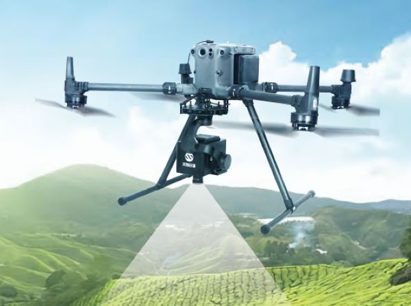
GaiaSky-mini3-VN hyperspectral imaging instrument
Case 2: Forest vegetation monitoring - accurately capturing "health signals"
Forest resources are widely distributed and the terrain is complex. Traditional ground monitoring is difficult to achieve full coverage and can easily cause damage to vegetation. The Shuangli Hepu unmanned aerial vehicle hyperspectral system provides an efficient solution for forest vegetation health monitoring.
In a provincial forest ecological monitoring project, drones equipped with hyperspectral imagers flexibly shuttle over the forest area to quickly obtain large-scale vegetation hyperspectral data. The system utilizes the technical characteristics of high spectral resolution and a large number of bands to accurately distinguish the health status of vegetation, and clearly identify "hotspots" (areas of vegetation damage and pest infection) and "dark spots" (areas of vigorous growth and health). Through data processing and analysis, the forestry department can timely grasp the trend of vegetation degradation, the spread path of pests and diseases, evaluate the ecological restoration effect, provide key data support for forest resource protection, forest fire warning and other work, and achieve the monitoring goal of "large-scale, non-destructive and high-precision".
Core product recommendation: Unlock the "hardcore equipment" for precise monitoring
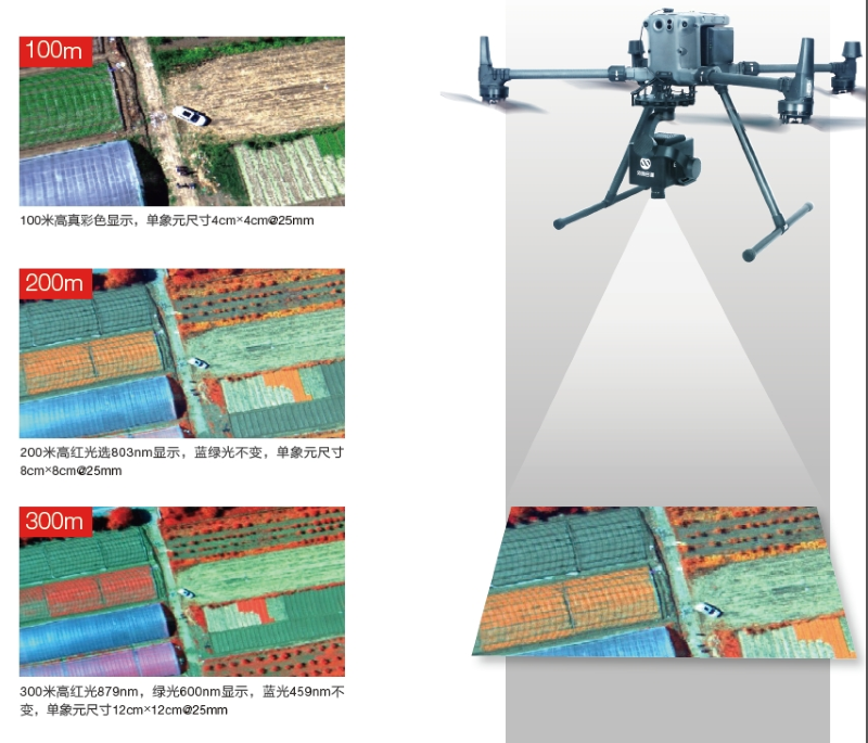
1. Gaiasky mini3-VN airborne hyperspectral imaging system
As a new generation portable airborne hyperspectral product, specially designed for small rotary wing unmanned aerial vehicles, it has the core advantages of high performance, easy operation, and flexible adaptation. Supports wireless remote control for Android and Apple devices, allowing for quick deployment; Integrating multidimensional information acquisition technology to obtain continuous narrowband data with high spectral resolution, meeting the monitoring needs of multiple scenarios such as agriculture, forestry, and environmental protection, it is the core equipment for accurate aerial perception.
2. Sunlight induced chlorophyll fluorescence monitoring system
Deeply integrated with rotary wing drones, focusing on precision agricultural monitoring scenarios. By capturing the chlorophyll fluorescence signal of crops, it accurately reflects the photosynthetic efficiency and physiological status of crops, providing core data for crop growth assessment, disease warning, and yield prediction, and opening up a new application model for precision agricultural monitoring.
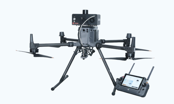
GaiaSky SP SIF unmanned aerial vehicle daylight induced chlorophyll fluorescence system
Jiangsu Shuangli Hepu Technology Co., Ltd. has been deeply involved in hyperspectral imaging technology for many years, providing timely and professional technical support and solution consultation to users across the country. The company always takes "technological innovation" as its core, integrating various high * technologies into the research and development of hyperspectral systems. The products have been verified through a large number of practical scenario tests to ensure accurate data and stable performance.
Whether it is the high yield demand of precision agriculture, the monitoring demand of ecological protection, or the precise requirements of water environment governance,Shuangli Hepu unmanned aerial vehicle hyperspectral imaging systemWe can provide customized and efficient solutions.