- Phone
-
Address
No. 98 Jianning Road, Gulou District, Nanjing City
Product Categories
Nanjing Juncan Instrument Equipment Co., Ltd


Survey of ancient and famous tree resources using 3D laser scanner
NegotiableUpdate on 06/26
- Model
- Nature of the Manufacturer
- Producers
- Product Category
- Place of Origin
Overview
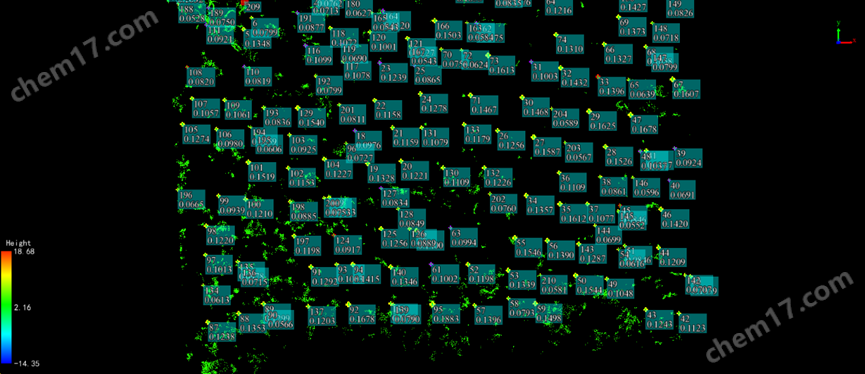
The survey of ancient and famous tree resources uses a 3D laser scanner to accurately collect growth indicators such as tree height, breast height diameter, and crown width, and systematically record habitat factors, providing scientific basis for subsequent applications to be included in the ancient and famous tree protection database.
Product Details
Survey of ancient and famous tree resources using 3D laser scannerP2 uses point cloud data obtained through 3D laser scanning to reconstruct trees in 3D, which can accurately obtain parameters such as tree morphology, diameter at breast height, crown surface area, and volume. This provides reliable basic data for research on tree growth trends, forest resource surveys, ecosystem carbon cycling, and protection of famous and ancient trees.

Survey of ancient and famous tree resources using 3D laser scannerP2 Technical Parameters
laser parameters
Scan point frequency per second:200,000 pts/s
FOV:360°x 59°
scanning distance:40 m @ 10%reflectance 70 m @ 80%reflectance
laser grade:1 Level eye safety
Hyperdense+: Support
resume scanning from breakpoint: Support
Built in camera
FOV (front camera):70°
FOV (Side camera):280°×149°
Resolution (front camera):2 MP
Resolution (Side camera):2 x 12 MP
visionSLAM: Support
image export: Support
image format:jpg
system parameters
Product dimensions:110×106×280 mm
Product weight:1500 g (Including controller battery, external camera andRTKmodule)
storage capacity:512G (Scalable to1TB)
Operating Temperature:-20℃ - 50℃
Storage temperature:-40℃ - 60℃
IPgrade:lP 54
Data export:Wi-Fi, USB Type-C, Uplate
Point cloud format:.las / .ply / .pts / .e57
precision
Real time point cloud accuracy:relative accuracy: 1.2 cm;absolute accuracy: 3 cm
Post processing point cloud accuracy:relative accuracy: 1.2 cm;absolute accuracy: 3 cm
external camera
Model:lnsta360 X5
360 video resolution(Insta360 X5):8K: 7680 x 3840 @ 30 / 25 / 24 fps
Electrical parameters
Battery endurance power supply:2H (Homework includesRTKModule, excluding external camera)
power consumption:21 W (Including an external camera)
charge:67W
GNSSparameter
satellite system:BDSTheGPSTheGLONASSTheQZSS
RTKprecisionH: 8 mm + 1 ppm RMS V: 15 mm + 1 ppm RMS