-
E-mail
406909520@qq.com
-
Phone
17312275363
-
Address
Mingfa Science and Technology Innovation Headquarters Base, No. 5 Pudong North Road, Pukou District, Nanjing City
Product Categories
Nanjing Weixin Space Information Technology Co., Ltd

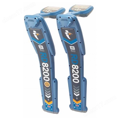
SLAM200E handheld laser scanner
NegotiableUpdate on 01/27
- Model
- Nature of the Manufacturer
- Producers
- Product Category
- Place of Origin
Overview
The SLAM200E handheld laser scanner is a high-precision, high-performance, and high-efficiency handheld laser scanner carefully developed by Pegasus Robotics, which integrates the respective characterization product features of the preceding SLAM100 and SLAM200.
Product Details
SLAM200E handheld laser scannerIt is a high-precision, high-performance, and high-efficiency handheld laser scanner carefully developed by Pegasus Robotics, which integrates the distinctive features of the preceding SLAM100 and SLAM200 characterization products. This scanner integrates high-frequency laser sensors, is equipped with two 12 megapixel panoramic cameras, has a built-in high-precision satellite positioning module, and a high-performance computing processing unit, bringing users a new experience of spatial data acquisition.
As a professional high-precision mobile measurement tool, SLAM200E naturally inherits the capabilities of its predecessor and can complete high-precision measurement and mapping work without satellite navigation positioning. It has a built-in high-performance computing and processing unit that supports real-time spatial data results of "edge acquisition, edge mapping, and edge coloring", and can achieve coordinate based real-time mapping when connected to external RTK. In addition, the SLAM200E has added multiple independently developed functional applications by Pegasus. In addition to supporting data breakpoint scanning, ground to ground point cloud data fusion, and high reality 3D GS restoration, the SLAM Instant APP has also been released synchronously, realizing real-time mapping once the measurement is completed. It is particularly suitable for specific industries that require rapid generation of measurement reports on the measurement site, greatly improving operational efficiency.
SLAM200E handheld laser scanner:
Support high-precision measurement between minutes and millimeters
As a professional high-precision mobile measurement tool, SLAM200E can achieve 5 mm relative accuracy measurement within a range of 60 meters and 1 cm relative accuracy measurement within a range of 100 meters; When connecting RTK or introducing control points, high-precision measurements with an accuracy of 2 cm can be achieved.
Distribution of collection points for relative accuracy verification
Distribution of precision verification control points
Support real-time mapping of benchmarks
The SLAM200E's high-precision real-time color point cloud, which can be scanned and drawn immediately, provides intuitive and detailed display of the results. By connecting RTK, a point cloud with coordinates can be directly generated, greatly improving operational efficiency. Real time point cloud acquisition can be achieved in the vast majority of typical application scenarios, including but not limited to urban surveying, engineering monitoring, and other fields, significantly shortening the post-processing cycle of the office.
Post processing/real-time coloring point cloud
Real time point cloud/post-processing point cloud details
Support high-precision 3D scene replication
The combination of high-precision point cloud and high-resolution image texture enables SLAM200E to accurately replicate 3D scenes, meeting the 3D data acquisition needs of applications with high 3D data requirements such as digital factories, digital exhibition halls, BIM, etc.
Support panoramic camera composite applications
Two 12 megapixel panoramic cameras can capture 360 degree wide field of view images and fine texture information, generating more realistic color point clouds and panoramic images. Panoramic camera data can be used for point cloud coloring, visual SLAM, panoramic image generation, 3D mapping, Gaussian splashing, and other operations.
Real time measurement
The conversion of massive point cloud data into final measurement results usually requires the use of professional post-processing software, and requires operators to possess professional skills and invest a lot of office time. The SLAM Instant APP of Feima Robotics can provide real-time measurement solutions for multiple scenarios, and after obtaining point cloud results in real-time in the field, industry reports can be quickly generated on-site.
Multi segment measurement
distance measurement
Area measurement
volume measurement
Integration of land and space
Handheld laser scanners can efficiently collect three-dimensional data above and below ground, but for some application scenarios, aerial three-dimensional point cloud data still needs to be supplemented. Feima Robot provides users with an air ground data fusion algorithm based on handheld laser scanner airborne mode and handheld mode, integrating 3D point cloud data, image data, and 3DGS data to provide an integrated air ground solution.
21st floor building and underground achievement map
21st floor building and underground side view
Gaussian Splatting
SLAM200E can generate, browse, and apply large-scale Gaussian splash data based on panoramic images. The Gaussian splash results and process data are in a universal format, making it easy to integrate with other application platforms. Gaussian Splashing Function Based on Handheld Laser ScannerLifetime freeuse.
Static station mode
The static station mode can effectively eliminate errors generated during the movement of handheld scanners, and efficiently obtain high-precision, high-precision, and high-density 3D point cloud data of challenging scenes; Support the collection of specific perspective data based on customer needs, and automatically concatenate and optimize static station data to further improve data quality and processing efficiency.
Handheld mode data, static station mode data
remote transmission
For mine operation, emergency and other application scenarios, the handheld laser scanner can transmit the mapping results to the command hall or control center in real time and remotely through the LAN or Internet during the real-time acquisition and modeling process, reduce the time consumption of data summary, quickly complete the acquisition of three-dimensional data in the target area, and gain valuable time for decision-making response.
Direct Internet transmission
LAN transmission
LAN forwarding
Multi platform support
The SLAM200E supports modular cross platform multitasking mode, allowing for easy adaptation and switching of cross platform applications such as drones, backpacks, vehicles, wearable assistive stands, tripods, etc.
SLAM GO APP
SLAM GO APP is a collection APP that is compatible with the full range of handheld laser scanners of Pegasus robots, and is fully compatible with Android and IOS systems. The APP establishes a stable connection with SLAM200E through WiFi, and SLAM200E can share mobile data network. The APP provides convenient data collection and control as well as powerful achievement management functions.
SLAM GO POST Pro
SLAM GO POST Pro is a PC software that comes with the full range of handheld laser scanners from Pegasus Robotics, embedded in the Drone Manager Professional Edition. This software can perform post-processing of SLAM200E collected data, produce high-precision and high-precision color point clouds, local panoramic images, and perform point cloud browsing and optimization processing.
SLAM Instant APP
SLAM Instant APP is a specialized tool developed by Pegasus Robotics for real-time measurement in the field. It can be installed on Android tablets and can quickly perform measurements and generate industry-specific measurement reports after completing field data collection.
Data browsing main interface 1
Data browsing main interface 2
LAN forwarding
Area function under orthophoto
Application Cases
APPLICATIONS
High density, high-definition replica real-time measurement 3DGS


Similar Product Recommend