- Phone
-
Address
No.388 Xinshi Middle Road, Qiaoxi District, Shijiazhuang City, Hebei Province, China. Hebei Jiyu Innovation Park 5-025
Product Categories
Shijiazhuang Shiya Technology Co., Ltd


Leaf Area Index Meter
NegotiableUpdate on 05/06
- Model
- Nature of the Manufacturer
- Producers
- Product Category
- Place of Origin
Overview
The core technology of leaf area index meter is based on two principles: photoelectric conversion and image analysis. The photoelectric conversion method generates diffuse reflection light by illuminating frosted glass with a uniform light source, which is then focused by a lens onto the surface of the photovoltaic cell to form a reference current. When the blade obstructs some of the light, the photocurrent intensity decreases linearly with the obstruction area, and the instrument directly converts the leaf area value by calculating the current attenuation ratio. This method has a short response time and is suitable for rapid calibration in laboratories.
Product Details
In the fields of precision agriculture and ecological research, leaf area index (LAI), as a core parameter for measuring vegetation coverage and photosynthetic efficiency, directly affects the accuracy of crop yield prediction, carbon sequestration capacity assessment, and environmental monitoring. The leaf area index meter quickly obtains plant canopy structure data through non-destructive measurement techniques, providing scientific basis for agricultural management, ecological research, and forestry investigations. This article will comprehensively analyze this modern scientific research tool from four dimensions: technical principles, functional characteristics, application scenarios, and operational points.
Technical principle: Accurate measurement of photoelectric and image fusion
The core technology of leaf area index meter is based on two principles: photoelectric conversion and image analysis. The photoelectric conversion method generates diffuse reflection light by illuminating frosted glass with a uniform light source, which is then focused by a lens onto the surface of the photovoltaic cell to form a reference current. When the blade obstructs some of the light, the photocurrent intensity decreases linearly with the obstruction area, and the instrument directly converts the leaf area value by calculating the current attenuation ratio. This method has a short response time and is suitable for rapid calibration in laboratories.
More advanced equipment uses a combination of fisheye lenses and CCD image sensors to capture three-dimensional structural images of the canopy through a 180 ° wide-angle lens. Combined with Bill's law and canopy porosity model, parameters such as photosynthetically active radiation (PAR) transmittance and leaf inclination distribution are calculated. For example, a certain model of instrument is equipped with 80 PAR sensors, which can synchronously collect radiation data in the 0-2700 μ mol/㎡· s band with a resolution of 1 μ mol/㎡· s, meeting the precise measurement requirements under complex lighting conditions.
Functional feature: Multi dimensional data supports scientific research decision-making
1. Core parameter measurement
Leaf Area Index (LAI): quantifies the total projected area of leaves per unit of land area, reflecting vegetation density.
Canopy structure parameters: including average leaf inclination angle, azimuth distribution, extinction coefficient, etc., revealing the canopy's ability to intercept light energy.
Radiation parameters: direct/scattered radiation transmittance, PAR vertical distribution map, to assist in the study of light energy utilization efficiency.
2. Intelligent operation design
Dual mode switching: supports automatic scanning and manual fixed-point measurement, suitable for different scenarios such as farmland and forests.
Large capacity storage: Built in 16GB storage card, can save 4000 records, supports exporting in EXCEL format.
Environmental adaptability: Operating temperature range of 0-60 ℃, stable operation under 100% relative humidity, equipped with TYPE-C fast charging interface and 2 3500mAh lithium batteries, with a battery life of up to 8 hours.
3. Data visualization and in-depth analysis
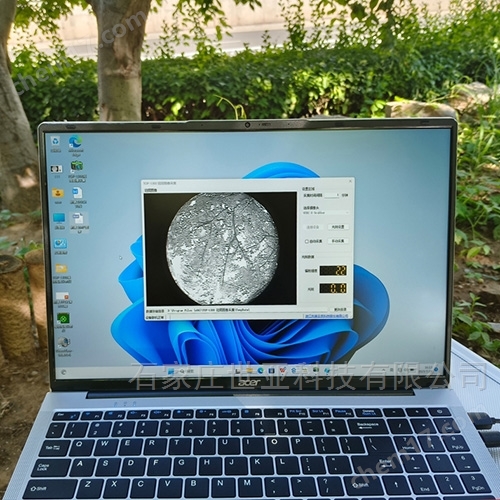
The dedicated software supports zenith angle and azimuth angle partitioning (10 zones each), which can block invalid image areas and improve data accuracy. Users can visually observe the distribution of leaf density through a three-dimensional canopy model, and generate a spatial LAI map based on GPS positioning information, providing decision support for precision fertilization and irrigation.
Application scenario: Covering the entire field of agriculture, forestry and ecology
1. Agricultural research and production
Crop growth monitoring: By regularly measuring changes in LAI, evaluate the impact of nitrogen fertilizer application on canopy development, and optimize fertilization plans.
Yield prediction: Combining PAR transmittance and leaf area density data, establish a photosynthetic product accumulation model to predict crop yield in advance.
Research on Adversity Stress: Monitoring the Dynamic Changes of LAI under Drought and Saline Alkali Conditions, Revealing the Mechanisms of Plant Stress Resistance.
2. Ecological research
Carbon sequestration capacity assessment: By long-term monitoring of forest LAI and combining it with biomass models to calculate changes in carbon storage.
Vegetation restoration evaluation: Quantify the vegetation coverage of degraded grassland or mining restoration areas and evaluate the effectiveness of ecological engineering.
Biodiversity research: Analyze the differences in LAI among different plant communities and reveal the mechanisms of species coexistence.
3. Forestry and Horticulture
Forest structure investigation: Quickly obtain the vertical distribution map of forest LAI to guide thinning intensity and tree species configuration.
Facility agriculture management: Real time monitoring of crop LAI in greenhouses, regulation of lighting and ventilation systems, and improvement of resource utilization efficiency.
Key points of operation: full process guide from calibration to data analysis
1. Preparation before measurement
Instrument calibration: Zero point calibration is required before daily use to ensure the accuracy of the photocurrent reference value.
Environmental adaptation: Allow the measurement area to stand still for 15 minutes to allow the instrument temperature to balance with the environment.
2. On site operation standards
Scanning path: Move the instrument longitudinally along the plant, keeping the probe vertical and 30-50cm away from the top of the canopy to avoid obstructing the sensor.
Data recording: Upon completion of each scan, immediately save the data and mark the GPS coordinates of the sampling point.
3. Data analysis and application
Outlier removal: Invalid data with PAR transmittance>90% or<5% are filtered through software.
Spatiotemporal analysis: Combining multiple years of LAI data, draw vegetation coverage change curves to reveal long-term ecological trends.
Conclusion
As a bridge connecting plant physiology and ecology, the Leaf Area Index (LAI) is driving the digital and precise transformation of agriculture, forestry, and environmental sciences. From laboratory basic research to intelligent management in the field, its multi parameter and high-efficiency measurement capabilities provide technical support for solving global challenges such as resource utilization and climate change.