-
E-mail
ustc_sc@163.com
-
Phone
18020740586
-
Address
Room 1503, Building A04, Software Park Phase III, Jimei District, Xiamen City, Fujian Province
Opu Tiancheng (Xiamen) Optoelectronics Co., Ltd
Unmanned aerial vehicle hyperspectral remote sensing: from alteration identification to gold target area delineation
Date: 2025-12-17Read: 2
Mineralization and alteration information
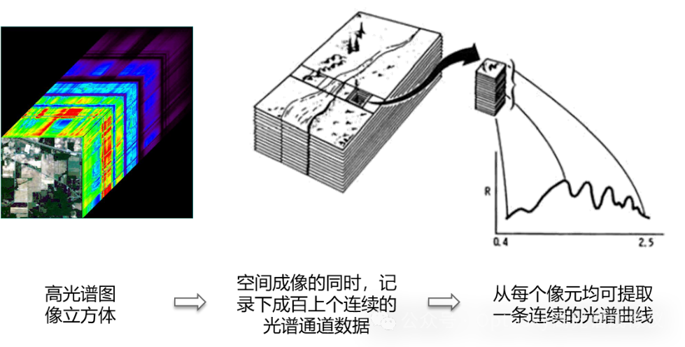
As an important strategic mineral resource of the country, gold resources are of great significance in ensuring the security of precious metal supply, supporting the new material industry, and stabilizing the financial system. With the continuous consumption of shallow and easily identifiable gold resources, current gold exploration is gradually expanding towards deep, concealed ore bodies, and complex structural areas, significantly increasing the difficulty of prospecting. The traditional gold exploration methods mainly rely on geological mapping, trenching, drilling, and geochemical sampling, which have problems such as long working cycles, high costs, limited coverage, and significant surface disturbance. Especially in areas with complex terrain, strong vegetation coverage, or rarely visited areas, their application efficiency and economy are significantly restricted.
Mineralization alteration information is an important direct or indirect indicator for gold exploration. Numerous studies have shown that the mineralization process of gold deposits is usually accompanied by various alteration processes such as silicification, sericitization, chloritization, and pyrite mineralization. Different types of altered minerals have significant and recognizable spectral characteristics in the visible near-infrared short wave infrared band. The spatial distribution and combination relationship of altered minerals can often effectively indicate the activity range of ore-forming fluids and potential gold enrichment areas, which is a key basis for narrowing the exploration target area and improving the success rate of exploration.
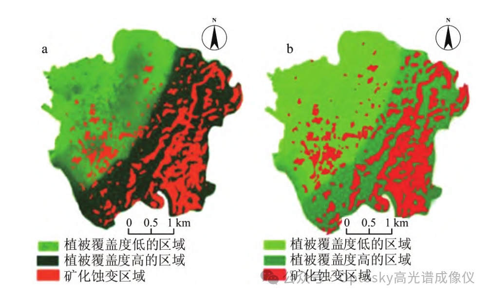
Hyperspectral remote sensing technology can obtain fine spectral information of land features under continuous and narrow band conditions, and has unique advantages in mineral identification, alteration information extraction, and mineralization prediction. Compared with traditional multispectral remote sensing, hyperspectral technology has higher accuracy in distinguishing mineral types, decomposing mixed pixels, and identifying alteration intensity. It has shown good application prospects in regional mineral surveys and mineralization prospect evaluations. However, traditional satellite or airborne hyperspectral systems are limited by spatial resolution, revisit periods, and task flexibility, making it difficult to meet the needs of fine mineral exploration in small and medium-sized mining areas.
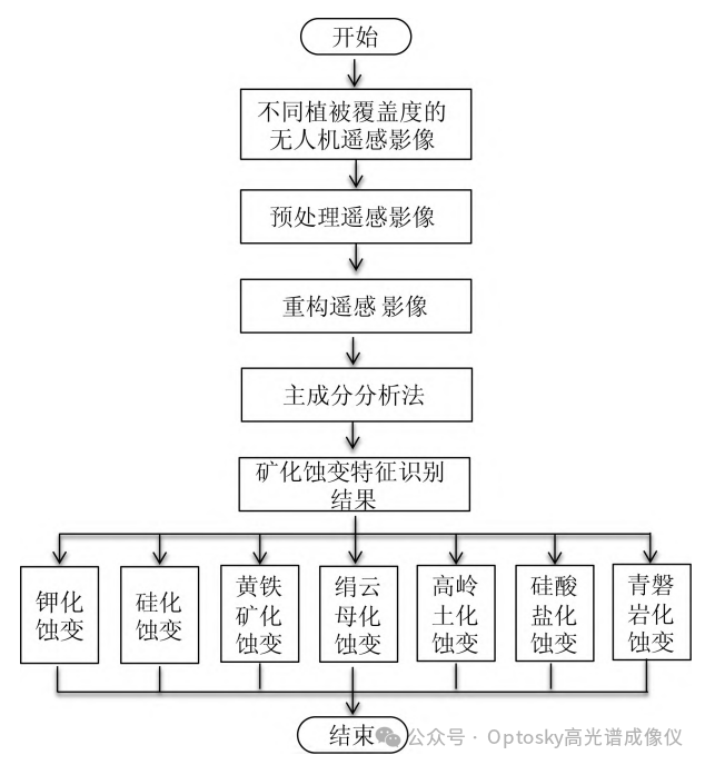
Identification of weathering information and target area delineation method
Identification and Target Area Delimitation Method of UAV Hyperspectral Remote Sensing Erosion Information
The unmanned aerial vehicle hyperspectral remote sensing technology provides an efficient and accurate technical means for the precise identification of mineralization and alteration information and the delineation of prospecting target areas by obtaining continuous and narrow band surface reflection spectral information on low altitude platforms. The core idea is to utilize the characteristic absorption and reflection differences of altered minerals in the visible light near-infrared short wave infrared band to achieve quantitative extraction of alteration types, spatial distribution, and their combination relationships, thereby serving the identification of favorable mineralization areas.
1. Acquisition and preprocessing of hyperspectral data from unmanned aerial vehicles
Firstly, based on the terrain undulation, mining area scale, and target alteration type of the research area, the drone flight altitude, route spacing, and overlap should be reasonably designed to ensure the acquisition of hyperspectral image data with high spatial resolution and high signal-to-noise ratio. The drone platform can be equipped with visible near-infrared or shortwave infrared hyperspectral imaging devices to conduct low altitude fine observation of mining areas.
The obtained data needs to go through a systematic preprocessing process, including radiometric calibration, dark current correction, geometric correction, and spectral smoothing, to eliminate sensor noise, atmospheric effects, and geometric distortions, and obtain true and reliable surface reflectance data, laying the foundation for subsequent identification of weathering information.
2. Spectral characteristics analysis of altered minerals
Typical altered minerals formed during mineralization and alteration processes, such as sericite, chlorite, kaolinite, calcite, and iron stained minerals, have clear diagnostic spectral characteristics in the hyperspectral range. For example, minerals containing hydroxyl groups often exhibit obvious absorption characteristics in the short wave infrared band, while iron oxides and iron hydroxides have characteristic reflectance changes in the visible near-infrared band.
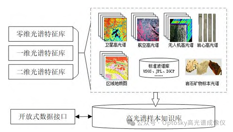
Through comprehensive analysis of field measured spectra, laboratory spectral libraries, and existing mineral deposit spectral data, a spectral feature model of typical altered minerals in the study area is established, providing criteria for automatic or semi-automatic identification of alteration information in subsequent images.
3. Methods for identifying and extracting alteration information
On the basis of completing spectral feature analysis, various hyperspectral data analysis methods can be used to identify and extract alteration information. Common methods include spectral matching techniques, feature band ratio analysis, continuum removal analysis, and machine learning based classification methods.
The spectral matching method calculates the similarity between the spectra of image pixels and known altered mineral spectra to identify the types of altered minerals; Characteristic band analysis utilizes the absorption characteristics of altered minerals in specific bands to construct indices or discrimination rules, highlighting abnormal information of alteration. For areas with severe spectral mixing, spectral unmixing techniques can be introduced to improve the accuracy of extracting alteration information.
4. Analysis of spatial distribution and combination of weathering anomalies
On the basis of identifying altered minerals, a comprehensive analysis is conducted on the spatial distribution characteristics of different types of alteration, with a focus on the combination relationship, intensity changes, and spatial coupling characteristics with structural lines and lithological boundaries of altered minerals. Usually, the alteration anomalies of hydrothermal deposits such as gold mines exhibit banded, ring-shaped, or linear distribution characteristics, which are clearly controlled by fault structures.
By analyzing the spatial superposition of alteration anomalies, it is possible to distinguish between regional background alterations and mineralization related alterations, and identify anomalous concentration areas with mineralization indicative significance.
5. Target delineation and evaluation of favorable mineral exploration areas
Based on the identification of alteration anomalies and spatial analysis, combined with existing geological, geochemical, and structural data, a comprehensive evaluation of the favorable mineralization of the study area is conducted. Based on the type, scale, intensity, and spatial combination of weathering anomalies, prospecting areas, key target areas, and general potential areas are divided.
The key target area is usually characterized by the superposition of multiple types of alteration, high anomaly intensity, and obvious structural control. By using unmanned aerial vehicle hyperspectral remote sensing to achieve precise delineation of target areas, the scope of mineral exploration work can be significantly reduced, providing clear targets for subsequent ground surveys, geophysical exploration, and drilling.
Opu Tiancheng hyperspectral equipment
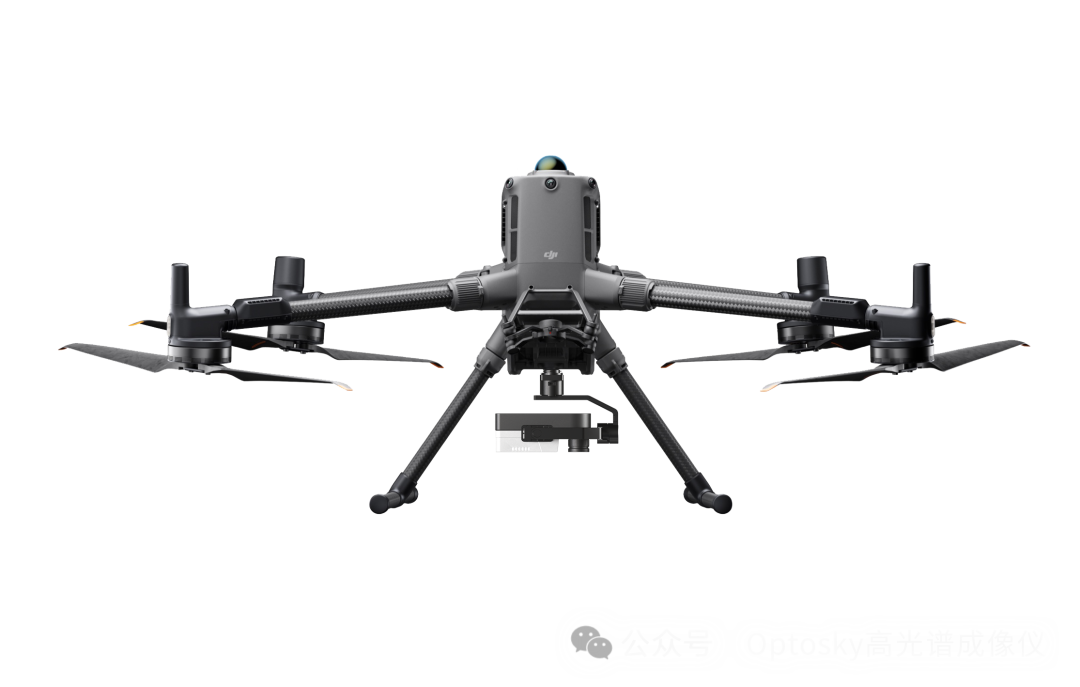
ATH9030 is the third generation unmanned aerial vehicle hyperspectral imaging instrument launched by Opu Tiancheng. It is a series of small-sized and lightweight unmanned aerial vehicle micro hyperspectral imaging instruments, consisting of six rotor/four rotor high stability unmanned aerial vehicles, high stability gimbal, hyperspectral imaging instrument, large capacity storage system, GPS navigation system, etc.
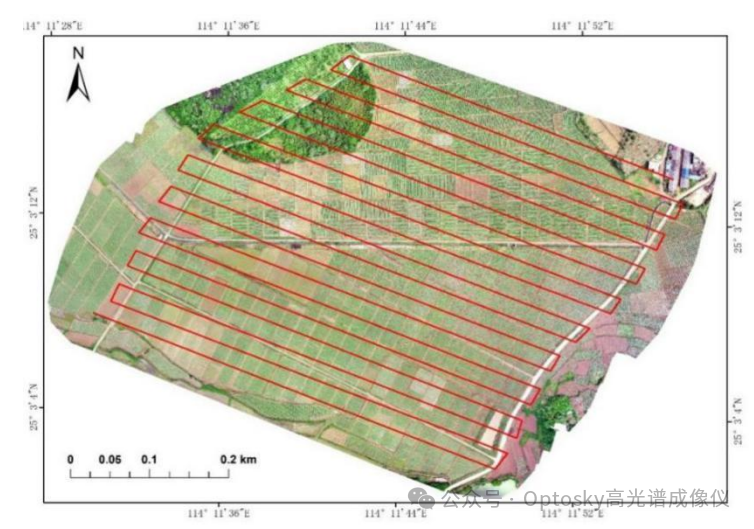
By obtaining and analyzing hyperspectral data from unmanned aerial vehicles, identifying and extracting abnormal mineralization and alteration information, delineating mineralization target areas, effectively reducing the possible areas for gold exploration, and improving the pertinence and success rate of exploration work.