-
E-mail
lina-he@zolix.com.cn
-
Phone
13810146393
-
Address
Feihong Road, Nanhu Avenue, Liangxi District, Wuxi City, Jiangsu Province
Jiangsu Shuangli Hepu Technology Co., Ltd
How to choose an airborne hyperspectral imager? Key indicators and inventory of domestic brands
Date: 2025-11-24Read: 1
1、 Definition of airborne hyperspectral imaging
Airborne hyperspectral imaging is a remote sensing technology that combines imaging technology with spectral analysis. It uses aircraft or drones equipped with hyperspectral imaging equipment to collect spatial and spectral information of target objects in continuous spectral bands (usually covering visible light to short wave infrared regions), forming a three-dimensional data cube (two spatial dimensions+one spectral dimension) that integrates spectra.
Core features:
·High resolution:Spectral resolution reaches the nanometer level (usually<10nm), capable of capturing subtle spectral differences
·Multi band:Obtain dozens to hundreds of consecutive narrowband information, far exceeding that of ordinary cameras
·Unified Graph:Each pixel has a complete spectral curve, which enables accurate identification of material composition
2、 Key points for purchasing
1. Spectral performance: matching application requirements
Spectral range: Geological exploration selects 1000-2400nm (short wave infrared); Agriculture and environmental monitoring select 400-1700nm (visible near-infrared+short wave infrared)
Spectral resolution: Geological fine exploration ≥ 2.5nm; Conventional monitoring 3.5-5nm; Research grade<1nm
Spectral channel count: ≥ 448 channels can meet most analysis needs
2. Platform adaptation: Ensure stable flight
Weight: ≤ 1.5kg, compatible with mainstream drones (such as DJI M300/M350)
Power consumption: ≤ 50W, ensuring battery life
Protection level: ≥ IP54, suitable for harsh weather conditions
3. Data Quality and Processing
Signal to noise ratio: the higher the better, ensuring weak signal detection capability
Calibration capability: Supports full process calibration of spectra, radiance, and reflectance
Data format: compatible with third-party software such as ENVI and MATLAB
Real time performance: Emergency monitoring needs to support real-time feedback and inversion
3、 Recommended Domestic High Quality Brands - Shuangli Hepu
1. GaiaSky-mini3-VN (visible light near red appearance)
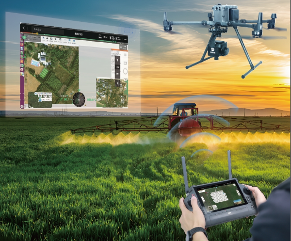
Integration of drone flight control software and hyperspectral camera software
Technical Specifications:
1. Spectral range: 400-1000nm (visible light+near-infrared)
2. Spectral resolution: 5nm (mean), 448 spectral channels (1X mode)
3. Spatial resolution: 0.06m (16mm lens, 100m height)
4. Weight: 1.2kg, fully compatible with DJI M350 RTK
5. Power consumption: 45W, strong battery life
2. GaiaSky-mini3-NIR (Near Red Appearance)
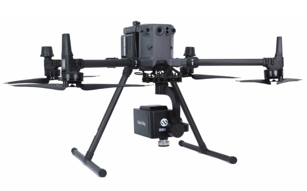
GaiaSKy-mini3-NIR near-infrared hyperspectral unmanned aerial vehicle system
Technical Specifications:
1. Spectral range: 900-1700nm (shortwave infrared)
2. Spectral resolution: 8nm (mean), 224 spectral channels (1X mode)
3. Spatial resolution: 0.13m (15mm lens, 100m height)
4. Weight: 1.35kg, compatible with mainstream drone platforms
5. Detector: High sensitivity InGaAs detector, excellent performance in low light environments
3. Other noteworthy products
GaiaSky SP SIF unmanned aerial vehicle daylight induced chlorophyll fluorescence system: an unmanned aerial vehicle daylight induced chlorophyll fluorescence system designed specifically for monitoring vegetation physiological status
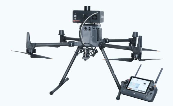
Sunlight Induced Chlorophyll Fluorescence System for Shuanglihe Spectrum Unmanned Aerial Vehicle
GaiaSky mini VLidar airborne LiDAR hyperspectral imaging multimodal system: integrates LiDAR+hyperspectral+thermal infrared+RGB camera to achieve multi-dimensional remote sensing data fusion
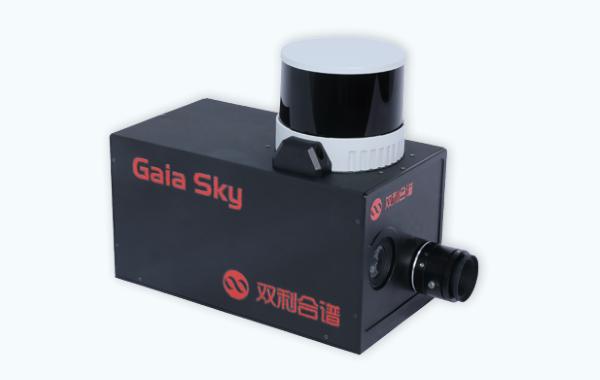
Dual benefit spectral multimodal airborne hyperspectral imaging system
4、 Summary and Suggestions
The GaiaSky-mini3 series products from Shuangli Hepu have become the leading domestic airborne hyperspectral imaging systems due to their technological innovation, outstanding performance, and high cost-effectiveness. For different application scenarios, it is recommended to choose:
Agriculture/vegetation monitoring: First GaiaSky-mini3-VN, covering chlorophyll sensitive bands, with the highest sex ratio
Geological/Mineral Exploration: First * GaiaSky-mini3-NIR, short wave infrared has excellent mineral recognition effect *
Comprehensive research requirement: Consider the GaiaSky-mini3-VN+NIR dual band system to obtain full spectral information in one flight